Modeling Terrain and Other Rounded Shapes模拟地形和其他圆形形状
Terrain is important to many SketchUp modelers: Your building needs ground to stand on, or maybe you're modeling the ground itself to create a landscape. 地形对许多SketchUp建模者来说很重要:你的建筑需要地面支撑,或者你正在对地面本身进行建模以创建景观。
But wait. SketchUp's Sandbox tools - the tools you use to model terrain - can also create forms completely unrelated to terrain. How can terrain include all these other possibilities?但是等等。SketchUp的沙盒工具——用于模拟地形的工具——也可以创建与地形完全无关的形状。地形如何包括所有这些其他可能性?
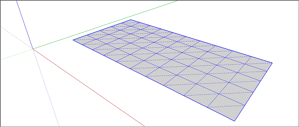
The secret is in the hidden geometry. When you're modeling terrain (or other shapes) with the Sandbox tools, you're technically sculpting a special type of geometry called a TIN, or triangulated irregular network. 秘密在于隐藏的几何体。当您使用Sandbox工具对地形(或其他形状)进行建模时,您在技术上正在雕刻一种称为TIN或三角不规则网络的特殊几何体。That's a fancy way of saying, "a group comprised of triangles." The following figure shows a flat TIN that hasn't been sculpted into anything yet.这是一种奇特的说法,“由三角形组成的组”。下图显示了一个尚未雕刻成任何东西的平面三角网。
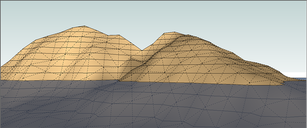
In the next figure, you see an example of a TIN sculpted into hills and a watery valley. The Sandbox tools are traditionally used to create this type of terrain.在下图中,您将看到一个雕刻成山丘和水谷的三角网示例。沙盒工具传统上用于创建这种类型的地形。
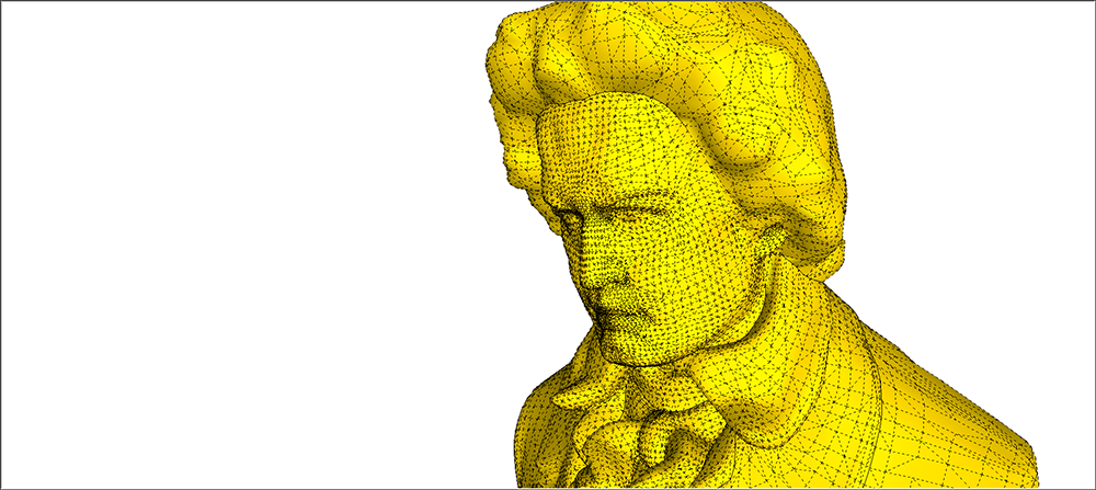
Reveal the hidden lines in this bust of Beethoven, and you can see it's also modeled from a TIN. 揭示贝多芬半身像中隐藏的线条,你可以看到它也是用三角网建模的。
In the following sections, you find out how to start modeling TINs, where to find the Sandbox tools, and what it means to geolocate terrain. After you cover the basics, you also find pointers to how to start sculpting a TIN.在以下部分中,您将了解如何开始对TIN进行建模,在哪里可以找到沙盒工具,以及地理定位地形意味着什么。在介绍了基础知识后,您还可以找到如何开始雕刻三角网的指导。
Table of Contents目录
Getting started with TINs开始使用TIN
To create a TIN, you can import contour lines from another program or import terrain from Google Earth via SketchUp's built-in tools. 要创建三角网,您可以从其他程序导入等高线,或通过SketchUp的内置工具从Google Earth导入地形。You can also transform contour lines that you draw yourself into a TIN, or draw a plain flat rectangular TIN like the one shown earlier in this article. 您还可以将自己绘制的等高线转换为三角网,或绘制一个如本文前面所示的平面矩形三角网。To get started, see Importing Preexisting Terrain and Creating Terrain from Scratch.要开始,请参阅导入现有地形和从头开始创建地形。
After you have a TIN in SketchUp, learn how to toggle the TIN's visibility, sculpt and fine-tine its features, and place other items on its surface.在SketchUp中创建三角网后,学习如何切换三角网的可见性,雕刻和精细标记其特征,以及在其曲面上放置其他项目。
Enabling the Sandbox tools启用沙盒工具
You find the Sandbox tools on the Sandbox toolbar or by selecting Tools > Sandbox and selecting your tool of choice from the submenu. As you read through this article's subarticles, you find out how to use each tool for its respective task.您可以在Sandbox工具栏上找到Sandbox工具,也可以选择“工具”>“沙盒”,然后从子菜单中选择所需的工具。在阅读本文的子文章时,您将了解如何将每个工具用于各自的任务。
Introducing geolocated terrain介绍地理定位地形
If you're modeling terrain, you can geolocate it, or embed geographical coordinates that place your terrain at a specific point on Earth. Geolocated models (or geomodels for short) offer a number of advantages:如果你在建模地形,你可以对其进行地理定位,或者嵌入地理坐标,将你的地形放置在地球上的特定点。地理定位模型(简称地理模型)具有许多优点:
Study the sunlight and shadows at different times of day and on different days of the year. Shadow studies can tell you things like whether adding a second story to a house will turn a sunny garden patch into a shady hosta bed. You can also see how the sunlight shines into an interior space at different times of day.研究一天中不同时间和一年中不同日子的阳光和阴影。阴影研究可以告诉你一些事情,比如在房子上加一层楼是否会把一片阳光明媚的花园变成一张阴凉的hosta床。您还可以看到阳光如何在一天中的不同时间照射到室内空间。View your model in Google Earth.在Google Earth中查看您的模型。Google Earth comes in free and paid versions that you download to your computer, and it's full of aerial imagery and models.谷歌地球有免费和付费两种版本,你可以下载到电脑上,里面充满了航拍图像和模型。This means you can view your model on the site where you plan to build it, surrounded by the buildings and landscapes that are already there.这意味着您可以在计划构建模型的网站上查看模型,周围环绕着已经存在的建筑和景观。If you're modeling something for clients, seeing a model in Google Earth is sure to impress them.如果你正在为客户建模,在谷歌地球上看到一个模型肯定会给他们留下深刻印象。
For details about shadow studies and viewing a model in Google Earth, see Communicating Your Designs. 有关阴影研究和在Google Earth中查看模型的详细信息,请参阅传达您的设计。As you model your terrain, know that you can geolocate it by importing terrain from Google, as explained in Importing Preexisting Terrain. 在建模地形时,要知道可以通过从Google导入地形来对其进行地理定位,如导入现有地形中所述。Also, Modeling Terrain for Google Earth offers tips and tricks that can improve your model's appearance in Google Earth.此外,为Google Earth建模地形提供了可以改善模型在Google Earth中的外观的提示和技巧。